Background: Geographic information science and technology (GIST) is an academic field that explains the importance of geospatial data and analysis. GIST is a powerful tool that has been successfully implemented to help address a number of significant health issues ranging from disease management to improved services. In this study, we have used GIST to help us develop an outpatient clinic plan for our hospital.
Purpose: To develop an outpatient clinic plan at an optimal location of a community hospital using GIST so as to meet the healthcare demands of the identified population of the area.
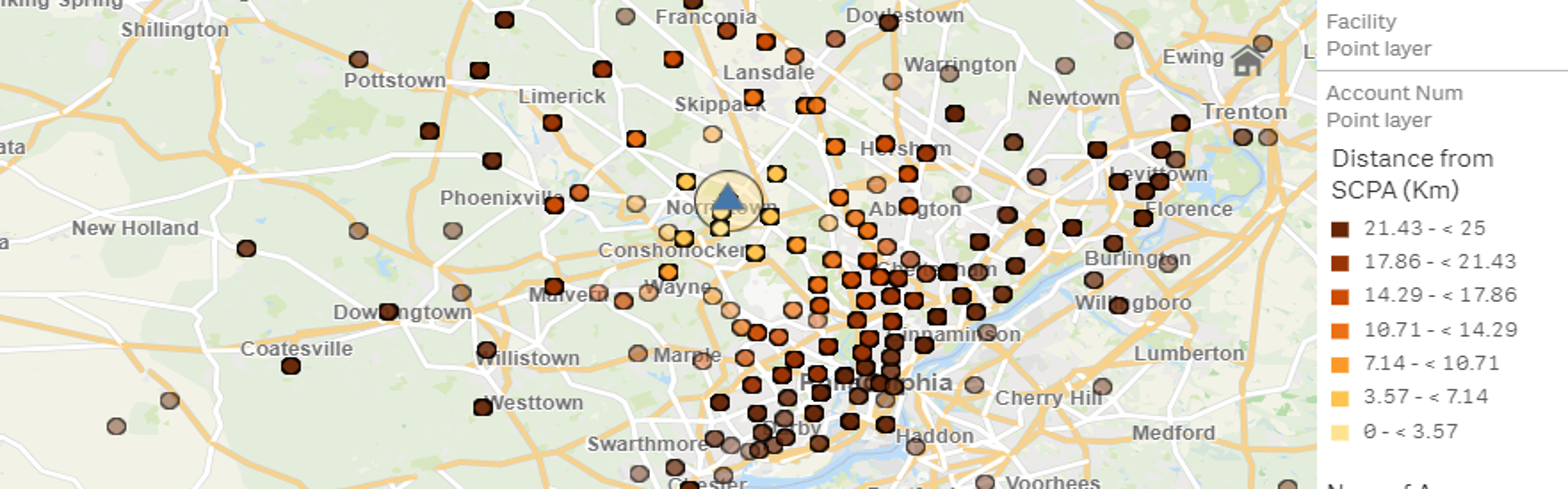
Description: Retrospective analysis was performed on a cohort of patients from the hospital inpatient (IP) and outpatient (OP) data set from 06/2019 to 07/2020. ICD10 codes were identified from the IP and OP dataset and stratified by age, gender, Zip codes of presenting population, Insurance type, Medicare Severity Diagnosis Related Groups (MS-DRG), primary diagnosis, associated comorbidities, and Healthcare Common Procedure Coding System (HCPCS codes). The data was loaded into Qlik dashboard with geospatial orientation in relation to the variables and location of our facility and zip codes of the presenting cases. We applied several strata rules and optimized the data to identify low socioeconomic group of people, with high BMI, and Diabetes and Cardiovascular morbidity, with no insurance distributed around 25-mile radius of the hospital.The sample considered patients within the 25-mile radius. The burden of the comorbidities in all-age population without insurance and primary care provider was geolocated by zip codes. From the geolocated sample with coordinates 5% of sample did not have insurance and PCP. This group is considered as the most vulnerable population
Conclusions: We identified the community health needs by disease category and customized population centric healthcare programs. The benefits of GIST will continue to rise as many people become aware about this and most importantly it helps in bringing a connection between the hospitals and the communities and helps in future pandemic preparedness.